Photo and video shooting using drones and unmanned aerial vehicles
This is a new look at the control of objects and a qualitative replacement for geodetic surveying.
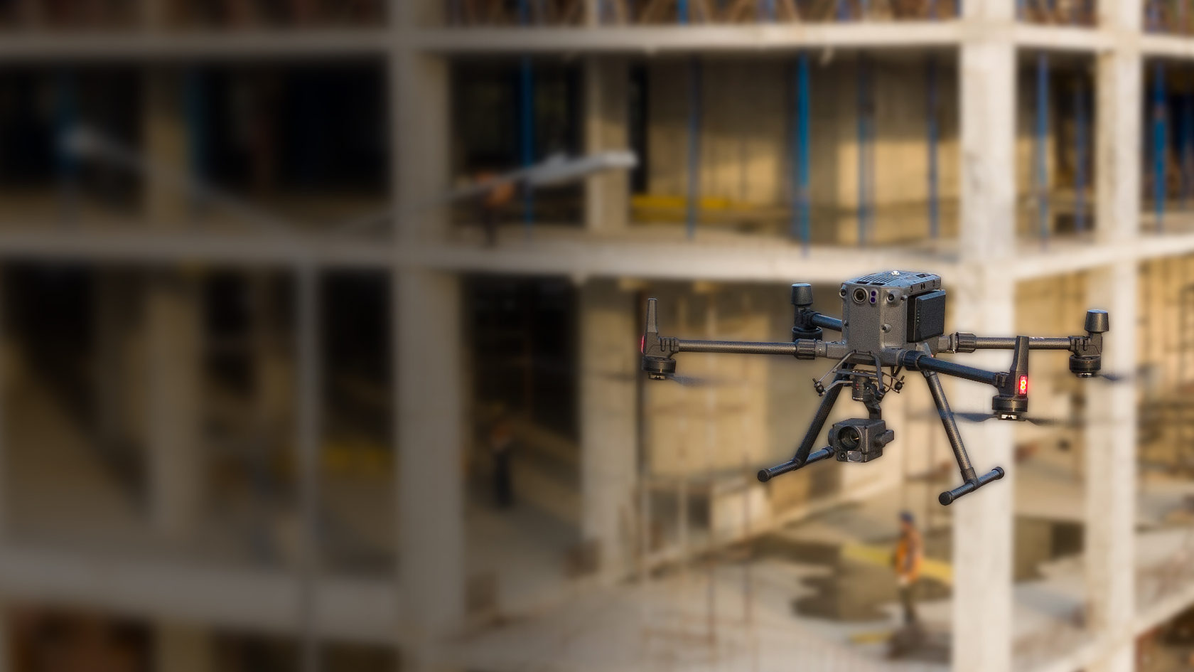
Дронопорты
Description
The drone takes off at a predetermined frequency from the drone port installed on the site. The task is performed automatically according to a pre-laid route. Flying drones create a sense of presence and stimulate workers who know that someone is watching them, and keep you informed about the progress on the site. Auto-change of the battery (without recharging), a security module and climate control are built into the station. The continuity of work is ensured thanks to five replaceable units.
Efficiency
Optimization of processes, increasing labor productivity.
Services
Photo and video monitoring
Unique angles, high resolution and general plans of the object for various areas of activity from demonstrating the progress of construction to filming the largest festivals.
Virtual tour
A series of 360° panoramic images in a virtual tour of the outside and inside the facility is an excellent solution for demonstrating tourist routes, monitoring and planning construction.
Online streaming
Live broadcast allows you to select plans and angles from the big screen and watch the object in real-time.
Ortophotoplan
A photographic terrain plan with geodetic reference is an exact copy of the object at any time of construction with a resolution of up to 5 cm/px.
Special offer - aerial laser scanning
Calculation of the volume
of earthworks
of earthworks
Fast survey to control performed work is provided in the classic
form of the executive scheme and a visual 3D model.
form of the executive scheme and a visual 3D model.
Calculation of the volume
of facade work
of facade work
Building facade surveys monitor the volume and area of work performed,
and the results can be used for a renovation project.
and the results can be used for a renovation project.
Construction site digital twin
Survey of the entire object creates a full-fledged copy in the form
of a point cloud, which can be viewed without special software
and make the necessary calculations based on a visual model.
of a point cloud, which can be viewed without special software
and make the necessary calculations based on a visual model.
Survey and analysis
for improvement
for improvement
Operational monitoring of the required area allows you
to calculate the actual deviations from the project
to calculate the actual deviations from the project
New solution for long-term projects — HIVE
Auto-change battery (without recharging) - after three minutes, the drone is ready to fly again
HIVE is a drone port for automated drone operation
The station has a built-in security module and climate control.
Thanks to several interchangeable charging units, the drone station works 24/7.

The drone takes off at any frequency of your choice from the drone port installed on the site. The task is performed automatically according to a pre-laid route. Flying drones create a sense of presence and stimulate workers who know that someone is watching them, and you always know what is happening on site.
Read more on hive.aero
Read more on hive.aero
The coverage area of one drone port is 100 km²
The drone port is suitable for any climate.
Learn how to use drones on site and integrate HIVE into your company's DNA
If you have any questions, fill out the form, and we will contact you!
By submitting the form, you agree to process your personal data